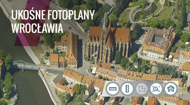
Department of Wroclaw Spatial Information System presents another material obtained as a result of a larger project of aerial photo inventory of the city in 2015. Vertically inclined photo maps of Wroclaw complement and complete picture of the city presented on the earlier (vertical) orthophotomap of Wroclaw.
The vertical photo maps shows almost every building in Wroclaw from four sides. The properly constructed mapping application allows switching seamlessly between different views, and performing rough measurements of the height of the visible objects.
The presented photo plans were created as a result of processing vertically inclined images of Wroclaw taken on May 3 and 4, 5 and 6 June 2015.
Due to optics and technical constraints, the image displayed on the vertically inclined photo maps doesn't reflect reality accurately, such as the ortophotomaps do. In some places there are some geometrical distortions, buildings tilting toward each other, etc. (Hence the approximate nature of the measurements taken on the vertically inclined photo maps.)
The application ukosne.gis.um.wroc.pl presents also the orthophotomap of Wroclaw (vertical pictures). The spatial extent of the orthophotomap is greater than that of the vertically inclined photo plans, thus the borders of Wroclaw include still available on the orthophotomap, but not available on the vertically inclined photo plans.
Details, including a short instruction manual of the new application (different from the ones presented thus far) and the spatial extent of the city included in the photoplans, are available at www.geoportal.wroclaw.pl.


